Friday 19 April 2013

Raft the Source of Nile


The Nile: It's exotic, historic and, yes, somewhat daunting. But forget about those Egyptian cruise ships lazing their way along the river - if you're looking for a real Nile adventure, head to its source in Southwestern Uganda and get in a raft.


Location: Southwestern Uganda
Ideal Time Commitment: One To Two Days
Best Time of Year: Year Round

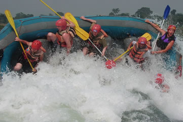
  • Feeling the rush of some of the best class V white-water rafting on the planet.
  • Glimpsing the untouched jungle and wild surroundings of the river.
  • Witnessing mountain gorillas in their natural habitat in the far southwest of Uganda.
  • Revelling in the wonder that you are standing at the source of the Nile- the longest river on the planet.
  • Speeding through the jungle on a mountain bike- just another activity to experience in the adrenalin capital of Africa.
  • Looking for crocodiles in the Nile- hopefully not when you are swimming in it!
The Nile stretches an astonishing 6680km, rising in the fertile greenery of Uganda, winding through the parched desert of Sudan and finally entering the historic sands of Egypt. Along the way, it transforms from a raging, rapid-choked thrill ride to a lazy, wide expanse navigated by riverboats overflowing with tourists.
The rapids there are graded class V- and since there's only one class above that, VI, you get the picture that this won't be a placid float down the river. You can expect big standing waves, rocks, drops, foaming hydraulics and plenty of white water. It's nothing that the raft, your guide, and hopefully you, can't handle.

Climb Mt Roraima, Venezuela


Here be dragons- at least, that's how it feels. For to ascend Venezuela's mightiest tabletop mountain, via a tangle of forest, an army of sandflies and punishingly slippery slopes, is to enter a prehistoric, and utterly unique, lost world.

Elevation: 2810 m
Location: Canaima National Park, Southeastern Venezuela 
Ideal Time Commitment: Five to Six Days
Best Time of Year: November to April
  • Watching waterfalls tumble off the top of neighboring tepui Kukenan- which, in Pemon, means "Place of Death".
  • Spending the night in Roraima "hotel", sandy areas sheltered by rock overhangs.
  • Scouring the tepui top for curious indigenous species- tiny black toads and unusual blooms.
  • Taking a dip in the jacuzzis- ice clear, icicle-cold pools on Roraima's summit.
  • Waiting for the mist to clear, to give sweeping, international views of where Venezuela, Guyana and Brazil meet.
  • Nursing wobbly legs, a sunburned nose and myriad jejane (sandfly) bites with a cold beer back in Paraitepui, after a climb well done.
"Inaccessible, accept by means of balloon." That was the verdict on Mt Roraima in 1872. By the latter half of the 19th century, several Western explorers had set their eyes on the highest of Venezuela's strange table-top shaped mountains, and all had determined it quite insurmountable- its foliage too dense, its situation too remote, its upper flanks too extraordinarily sheer.
Often the mesa is draped in a dramatic tablecloth wispy white (it rains virtually every day). But when the linen is whipped off, the vastness is revealed; from here, you can look out over three countries, and across to other tepuis, which all have their own secret summits.


Pedal The Camino De Santiago


For centuries, pilgrims have been foot-slogging their way across Northern Spain to Santiago De Compostela, to pay homage to the remains of the Apostle James. Today, a new breed comes on wheels and 27 gears.

Distance: 783 km
Location: Northern Spain
Ideal Time Commitment: Two Weeks
Best Time of Year: May to June, September to October

  • Setting your wheels down, ready to ride, on the French border at Puerto de lbaneta, the same Pyrenean pass Napolean used to launch his 1802 occupation of Spain.
  • Drinking wine from a water fountain through La Rioja.
  • Carrying a stone to place at Cruz de Ferro, the cross atop the Montes de Leon.
  • Getting your Credencial del Peregrino stamped each day as you cycle west.
  • Threading through weary walkers as you arrive in Praza do Obradoiro, beside Santiago's cathedral.
Beginning in the border town of Roncesvalles, the ride descends the Pyrenees into the city of Pamplona before crossing the wine region of La Riojam where fountains dispense wine for pilgrims. Crossing the high plateau between Burgos and Leon is the Camino's version of penance- a long, bland haul that has many walkers jumping on buses. Here, you'll be very glad you came by bike.
Across the epic O Cebreiro climb, the Camino finally enters Galicia, a world apart from the dry plateau. Rainswept and green, this region provokes a hilly final 150km into the mazelike old town of Santiago, where one final scallop shell- the symbol of St James- marks the pilgrimage's end outside the city's cathedral.

Sunday 14 April 2013

Kayak Mosquito Bay


Nature can be fantastically weird. And perhaps nowhere more so than in Puerto Rico. For here, in a few select bays- of which there are just a handful worldwide- you can kayak right through the world's most wonderful watery light show.

Distance: 6KM to 10 KM
Location: Mosquito Bay, Vierques, Puerto Rico
Ideal Time Commitment: Two to Four Hours
Best Time of Year: Around the new moon, year-round
  
  • Watching the sun set over the lapping Caribbean with a cool rum cocktail and a blast of salsa romantica.
  • Navigating around the mazelike mangrove trees, which become an otherworldy- and slightly creepy- realm in the darkness.
  • Tracing myriad fish gliding through the bioluminescence, leaving trails of glowing blue in their wakes.
  • Gazing up at a blanket of stars- and then down, to see those same celestial speckles of perfectly reflected in the waters below; watch out for shooting stars.
  • Dipping you paddle into the bay of delight at the halo of light created around its gentle thrust.

Pyrodinium bahamense  are ancient species of dinoflagellate- or minuscule spheres of sea gunk, to you and me. These 446-billion-year-old organisms very much like the water of Puerto Rico, at least in a few choice spots. They like the vitamins released by the roots of red mangrove trees, the relatice lack of any pollution and the limited tidal exchange of their favoured bays. And because they like it here, they treat us to their unique pyro-tastic show.
There are fewer than 10 places worldwide where this phenomenon occurs, and Puerto Rico is arguably the most spectacular.  There are three bioluminescent bays on the archipelago.
Here, you can head out after sundown in a kayak and watch as the world beneath you starts to glow. This is not a physical test of an adventure, but a chance to see nature at its most beautifully bizarre.


Trek Corsica's GR20 Trail


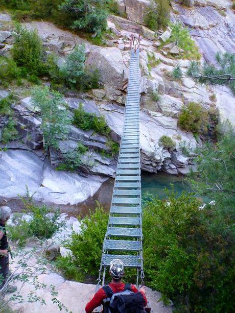
Lace up your hiking boots to pierce the unforgiving granite heart of Corsica. Tramp rugged trails across shepherds' pastures, past high alpine lakes and through pine-scented forests on the route lauded as Europe's toughest trek and France's grandest Rondonnee.

Distance: 170KM
Location: Corsica, France
Ideal Time Commitment: 12 to 16 Days
Best Time of Year: June to Mid-July, Mid-September to Mid-October

  •  Catching your breath at the summit of 2706m-high Monte Cinto- then gasping at the breathtaking panoramic vistas across northern Corsica.
  • Drinking in the sunset at the Refuge d'Ortu di u Piobbu after your first day's hike, before tuckering into hearty soupe corse.
  • Tackling the chains and ladders leading across the vertigo-inducing Cirque de la Solitude.
  • Admiring the exquisite glacial lakes of Capitellu  and Melu from the path descending from high-level pass Breche de Capitellu- the trail's highest point.
  • Watching climbers- and perhaps a mouflon- haul themselves up the crags of the Aiguilles de Bavella.

Corsica's iconic Grande Randonnee (meaning, literally, "Great Walk") was pioneered 40 years ago, the brainchild pf alpinist Michel Fabrikant. As the Coriscan name Fri li Monti suggests, the rail leads hikers across- and in many cases over- the mountainous interior of this rugged Mediterranean island, stretching 170km between the northern village of Calenzana and Conca, the southern trailhead.
As it's often seen as Europe's toughest long-distance trek, completing all 16 stages of the GR20 is considered a badge of honour for hardcore hikers. But it's also a chance to penetrate deep into the island's remote uplands, accessing the natural and cultural treasures that seem most inaccessible.
The payoff though, is immense. The Park Naturel Regional de Corse, created in 1972 to coincide with the opening of the GR20 trail that weaves through its higher reaches, protects areas of stupendous beauty- alpine lakes, forests of chestnut and oak, stands of Laricio pine and unique Coriscan scrub called the maquis- among which lammergeier and osprey soar above wild boar, Coriscan mouflan and, of course, intrepid trekkers.

Sunday 7 April 2013

Explore Kruger's Wilderness Trails

 Getting deep into Africa doesn't mean spotting the big five from the comfort of a Safari Jeep. It's getting out, on foot, into quiet wilderness isolation, seeing the details that make the whole, and feeling the heart of Africa beating strong.

Distance: Up to 50KM
Location: Kruger National Park, South Africa
Ideal Time Commitment: Seven Days
Best Time of Year: Year Round
Essential Tip: Obey your guide unquestionably- your safety depends on it

  • Immersing yourself in African nature: no barriers or fences, just you and the bush
  • Revelling in a silence so profound, you can hear your own heart beat
  • Thrilling at the real, though carefully managed, danger of meeting animals face-to-face in the wild
  • Spotting a rarely seen bird like the gorgeous, elusive Narina trogon- and finding that just as exciting as sighting one of the Big Five game
  • Seeing the ancient, mystical rock art of this area's earliest inhabitants
  • Falling asleep to the night-time sounds of the bush
The Kruger's National Park is a vast swathe of bushland on South Africa's eastern border with Mozambique. Covering nearly 20,000 sq km, it's on of the largest national parks in Africa, a natural world little altered since the indigenous San people first lived here 20,000 years ago. Game spotters have been coming here since 1898, when the park was founded, but most visitors still see the park from behind the windscreens of their vehicles- only disembarking in the safety of rest camps.
With all those caveats, walking in the wilderness of the Kruger National Park is nothing short of an adventure of a lifetime. This is a magnificent journey on which you can feel like the first human that trod the Earth. You'll travel through a glorious African Garden of Eden, and shed the burdens of modern life. These days in the wilds could change you forever.


Sail Croatia's Dalmatian Coast


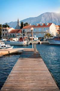
Weigh anchor, hoist the mainsail, and with the islands of Dalmatia before you, sail between the historic and natural jewels of Croatia's Adriatic coastline. When a little landlubbing appeals, come ashore to forested coves, fishing villages and ancient fortified towns.

Distance: 360 KM
Location: Dalmatia, Croatia
Ideal Time Commitment: Two to Three Weeks
Best Time of Year: May to Mid-July, Mid-August to September

  • Arriving in a deserted cove, dropping anchor into the azure depths, and plunging in.
  • Wandering in awe through ancient World Heritage- listed towns and peaceful, historic fishing villages.
  • Smelling the scent of sun-warmed pine wafting over your boat as you pass forested islands.
  • Catching fish as you sail and barbequing them over the coals on a remote beach.
  • Feeling the salt spray fresh on your face as the maestral breeze fills your sails and you cruise to the next gorgeous anchorage.
  • Savouring fabulous seafood alfresco at the tiniest harbourside restaurant, and sipping Croatian wine as you laugh with the locals.
 The Dalmation coast of Croatia is 360 km long, stretching from the town of Zadar in the north to the Bay of Kotor on the border with Mentenegro to the south. It takes in the dramatic and historic cities of Split and Dubrovnic, over a thousand islands, countless beaches, jewel-like coves and quiet bays.
Island hopping off Dalmatia is as much about the stopping as the time at sea. Cruise your yacht among the 147 (mostly uninhabited) Kornati Islands, where impossibly clear waters fringe sculpted cliffs and caves. Or try Mljet Island, which supports the eponymous densely pine-forested national park. Then check out the magnificent Diolcletian's Palace in Split, started in AD 295, and the Unesco World Heritage city of Dubrovnik, founded in the 7th Century.
The heartbreakingly gorgeous island of Hvar, with its olive groves, lemon trees and perfect medieval villages, has been well and truly "discovered", so if you want to see perhaps the most beautiful island in Dalmatia, you'll have to put up with the crowds. There are countless other nameless stretches of sand and secret coves that only a sailor can get to.